Climate & Energy Design Data
ASHRAE / IECC Climate Zones Explained (Zones 1–8, A/B/C)
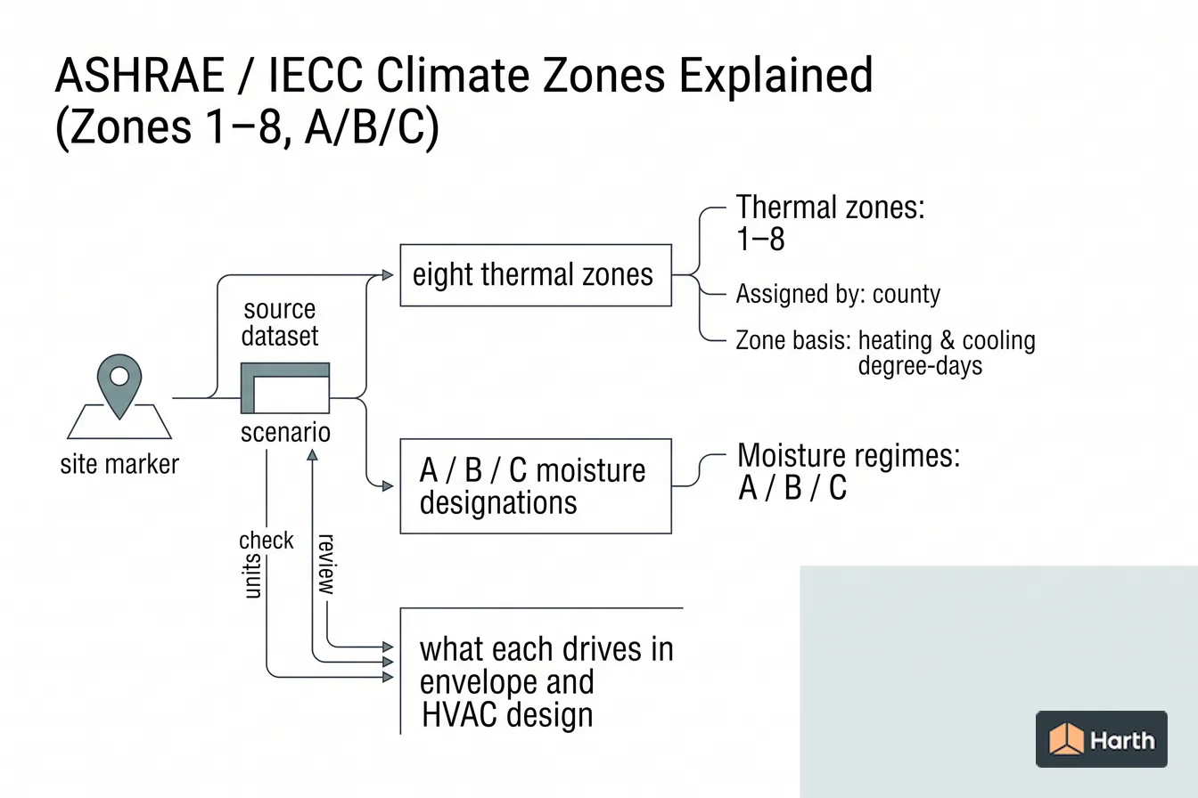
The IECC / ASHRAE 169 climate zone system — the eight thermal zones, the A/B/C moisture designations, and what each drives in envelope and HVAC design.
On this page
Last updated August 14, 2026 · Climate zone definitions, county assignments and moisture criteria from the International Energy Conservation Code (Tables R301.1, R301.3, C301.1 and C301.3 in the 2021 and 2024 editions, compared with Table R301.1 of the 2018 IECC), which follow ASHRAE Standard 169-2013. County reassignment counts and the 90.1 map history are from PNNL analyses for the U.S. Department of Energy; Canadian zones are from the National Building Code of Canada 2020, Tables 9.36.2.6.-A and C-2. The county assignment and any amendment in the energy code edition your AHJ has adopted are authoritative; values here are typical and should be verified against that edition. Official references: [ASHRAE Standard 169 scope](https://www.ashrae.org/technical-resources/standards-and-guidelines/titles-purposes-and-scopes); [2024 IECC climate zones](https://codes.iccsafe.org/content/IECC2024V1.1/chapter-re-3-general-requirements); [2021 IECC residential climate zones](https://codes.iccsafe.org/content/IECC2021P2/chapter-3-re-general-requirements); [2021 IECC commercial climate zones](https://codes.iccsafe.org/content/IECC2021P2/chapter-3-ce-general-requirements); [2018 IECC climate zones](https://codes.iccsafe.org/content/IECC2018/chapter-3-re-general-requirements); [PNNL 2021 IECC residential analysis](https://www.energycodes.gov/sites/default/files/2021-07/2021_IECC_Final_Determination_AnalysisTSD.pdf); [PNNL guide to climate zones by county](https://www.osti.gov/servlets/purl/1893981/); [PNNL 90.1-2016 analysis](https://www.energycodes.gov/sites/default/files/2021-07/02202018_Standard_90.1-2016_Determination_TSD.pdf); [ASHRAE 90.1-2022 Addendum v](https://www.ashrae.org/file%20library/technical%20resources/standards%20and%20guidelines/standards%20addenda/90_1_2022_v_20240531.pdf); [National Building Code of Canada 2020](https://nrc-publications.canada.ca/eng/view/object/?id=515340b5-f4e0-4798-be69-692e4ec423e8).
Direct answer
ASHRAE Standard 169 sorts climates into nine thermal zones, 0 to 8, by heating degree-days (base 65°F) and cooling degree-days (base 50°F), and adds a moisture letter: A for moist, B for dry and C for marine. The United States spans Zones 1 to 8. Zone 0 entered with ASHRAE 169-2013, and the 2021 IECC was the first edition to include it. The IECC and ASHRAE 90.1 assign every U.S. county a zone in Tables R301.1 and C301.1, so the lookup is by county, not by reading colours off a map. The 2021 IECC moved about 400 counties, mostly to a warmer zone, such as Dallas County from 3A to 2A, and the 2024 IECC kept the 2021 county table unchanged. The zone sets prescriptive envelope targets such as insulation R-values and fenestration U-factor and SHGC limits. HVAC equipment is sized separately, to ASHRAE Handbook design temperatures.
Content and cited inputs reviewed by Harth team · Published 2026-08-14 · Updated 2026-08-14.
What are the key takeaways?
- Thermal zones: 0–8 (1–8 in the U.S.)
- Moisture regimes: A / B / C
- Zone basis: HDD65 and CDD50
- U.S. zone and letter combinations: 16
Which climate inputs control the design?
The climate zone map used by U.S. energy codes comes from ASHRAE Standard 169, Climatic Data for Building Design Standards. The same map underlies the IECC (residential and commercial provisions) and ASHRAE 90.1 (the commercial energy standard). ASHRAE 169-2013 defines nine thermal zones, from Zone 0 (extremely hot) to Zone 8 (subarctic), based on heating and cooling degree-days, and adds a moisture letter (A, B or C) on top. The United States spans Zones 1 to 8; no U.S. county falls in Zone 0. Every U.S. county is assigned a zone in the code's lookup table, so you look the zone up rather than calculate it.
The thermal zones at a glance
| Zone | Thermal character | Envelope emphasis |
|---|---|---|
| 0 | Extremely hot (no U.S. counties) | Same residential IECC values as Zone 1 |
| 1 | Very hot | Cooling + solar control; low SHGC |
| 2 | Hot | Cooling-dominated; shading, low SHGC |
| 3 | Warm | Balanced, cooling-leaning |
| 4 | Mixed | Balanced heating/cooling |
| 5 | Cool | Heating-leaning; more wall/roof R |
| 6 | Cold | Heating-dominated; high R, low U |
| 7 | Very cold | High R, thermal-bridge control |
| 8 | Subarctic / arctic | Maximum R; continuous insulation |
How is each climate zone defined?
The zone number comes from annual heating degree-days to base 65°F (HDD65) and cooling degree-days to base 50°F (CDD50), or HDD18 and CDD10 in SI units. The thresholds below are from IECC Table R301.3 (residential) and Table C301.3 (commercial). They are identical in the 2021 and 2024 editions and follow ASHRAE 169-2013.
| Zone | IP criteria | SI criteria |
|---|---|---|
| 0 | CDD50 > 10,800 | CDD10 > 6000 |
| 1 | 9,000 < CDD50 < 10,800 | 5000 < CDD10 < 6000 |
| 2 | 6,300 < CDD50 ≤ 9,000 | 3500 < CDD10 ≤ 5000 |
| 3 | CDD50 ≤ 6,300 and HDD65 ≤ 3,600 | CDD10 < 3500 and HDD18 ≤ 2000 |
| 4 | CDD50 ≤ 6,300 and 3,600 < HDD65 ≤ 5,400 | CDD10 < 3500 and 2000 < HDD18 ≤ 3000 |
| 5 | CDD50 < 6,300 and 5,400 < HDD65 ≤ 7,200 | CDD10 < 3500 and 3000 < HDD18 ≤ 4000 |
| 6 | 7,200 < HDD65 ≤ 9,000 | 4000 < HDD18 ≤ 5000 |
| 7 | 9,000 < HDD65 ≤ 12,600 | 5000 < HDD18 ≤ 7000 |
| 8 | HDD65 > 12,600 | HDD18 > 7000 |
Zones 0 to 2 are set by cooling degree-days alone and Zones 6 to 8 by heating degree-days alone; Zones 3 to 5 depend on both. Zone 0 first appeared in ASHRAE 169-2013 and entered the IECC in the 2021 edition. The 2018 IECC definitions table started at Zone 1.
What do the A, B and C moisture letters mean?
Zones 0 to 6 also carry a moisture regime. The IECC (Section R301.3 / C301.3) defines them as follows:
- C — Marine (e.g. the Pacific coast): a location that meets all four tests. The coldest month averages between 27°F and 65°F (−3°C to 18°C). The warmest month averages below 72°F (22°C). At least four months average above 50°F (10°C). Summers are dry: the wettest month of the October–March cold season gets at least three times the precipitation of the driest month in the rest of the year.
- B — Dry (e.g. the interior Southwest and Mountain West): not marine, and annual precipitation is below a threshold that rises with annual mean temperature. The IECC gives three versions of the threshold equation depending on how much of the year's precipitation falls in the April–September high-sun period.
- A — Moist (e.g. most of the eastern U.S.): any location that is neither marine nor dry.
Where only degree-day data are available, the IECC classes a Zone 3 location with CDD50 ≤ 4,500 as 3C, a Zone 4 location with CDD50 ≤ 2,700 as 4C, and a Zone 5 location with CDD50 ≤ 1,800 as 5C. So a full designation looks like 4A (mixed-humid), 3B (warm-dry), or 4C (marine). Zones 7 and 8 carry no letter in the U.S. county table. The letter drives vapor-control strategy, meaning where and whether to place a vapor retarder, and in some tables which prescriptive values apply.
How do I find my climate zone?
- Confirm the code edition in force. Your state or city adopts a specific IECC edition, or ASHRAE 90.1 for commercial work, and may amend the map. The zone has to come from that edition.
- Look up the county. IECC Table R301.1 (residential) and Table C301.1 (commercial) list every U.S. county and territory by state, with the zone number, the moisture letter and an asterisk for Warm Humid counties. Some states are a single zone: in the 2021 and 2024 IECC all of Massachusetts is 5A, Vermont 6A, Montana 6B and Hawaii 1A.
- Use the map for orientation only. IECC Figure R301.1 / C301.1 and PNNL's county maps for the Department of Energy show the same assignments, but county lines are hard to read at map scale, so confirm with the table.
- Outside the U.S. table, work out the thermal zone from HDD65 and CDD50 using Table R301.3, then apply the A/B/C definitions. ASHRAE 90.1 sends Canadian and international projects to the station tables in Standard 169 first.
- Record the zone with its edition and source on the project, because the 2018 and 2021 IECC county tables differ.
Which counties changed climate zone in the 2021 IECC?
The 2021 IECC adopted the ASHRAE 169-2013 county map, which recalculated zones from more recent weather data. PNNL's analysis for the Department of Energy reports that about 400 of more than 3,000 U.S. counties were reassigned, most to a warmer zone. The 2024 IECC kept the 2021 county table unchanged. Examples from Table R301.1:
| County (city) | 2018 IECC | 2021 and 2024 IECC |
|---|---|---|
| Dallas County, TX (Dallas) | 3A | 2A |
| Tarrant County, TX (Fort Worth) | 3A | 2A |
| Davidson County, TN (Nashville) | 4A | 3A |
| Wake County, NC (Raleigh) | 4A | 3A |
| Franklin County, OH (Columbus) | 5A | 4A |
| Marion County, IN (Indianapolis) | 5A | 4A |
| Milwaukee County, WI (Milwaukee) | 6A | 5A |
| Palm Beach County, FL | 2A | 1A |
| Cameron County, TX (Brownsville) | 2A | 1A |
| Kitsap County, WA (Bremerton) | 4C | 5C |
| Juneau, AK | 7 | 6A |
| Allegany County, MD (Cumberland) | 4A | 5A |
| Kay County, OK (Ponca City) | 3A | 4A |
A minority moved colder, including Allegany County, Maryland and a group of northern Oklahoma counties. Zone 5C appears in the U.S. county table for the first time in 2021: Clallam, Island, Kitsap and San Juan counties in Washington, and Ketchikan Gateway, Prince of Wales–Outer Ketchikan and Sitka in Alaska.
Climate zone examples by zone (1A, 4A, 4C and more)
Representative counties from IECC Table R301.1 (2021 and 2024 editions):
| Zone | Example cities (county) |
|---|---|
| 1A | Miami (Miami-Dade, FL), Key West (Monroe, FL), Brownsville (Cameron, TX), Honolulu (all of Hawaii), San Juan (Puerto Rico) |
| 2A | Houston (Harris, TX), Dallas (Dallas, TX), Austin (Travis, TX), New Orleans (Orleans, LA), Tampa (Hillsborough, FL) |
| 2B | Phoenix (Maricopa, AZ), Tucson (Pima, AZ), Yuma (Yuma, AZ) |
| 3A | Atlanta (Fulton, GA), Nashville (Davidson, TN), Charlotte (Mecklenburg, NC) |
| 3B | Los Angeles (Los Angeles, CA), San Diego (San Diego, CA), Las Vegas (Clark, NV) |
| 3C | San Francisco (San Francisco, CA), Oakland (Alameda, CA), San Jose (Santa Clara, CA) |
| 4A | New York (New York County, NY), Washington, D.C., Baltimore (MD), St. Louis (MO) |
| 4B | Albuquerque (Bernalillo, NM) |
| 4C | Seattle (King, WA), Tacoma (Pierce, WA), Portland (Multnomah, OR), Eugene (Lane, OR) |
| 5A | Chicago (Cook, IL), Boston (all of Massachusetts), Milwaukee (Milwaukee, WI) |
| 5B | Denver (Denver, CO), Salt Lake City (Salt Lake, UT), Boise (Ada, ID), Reno (Washoe, NV) |
| 5C | Port Angeles (Clallam, WA), Sitka (AK) |
| 6A | Minneapolis (Hennepin, MN), Burlington (all of Vermont), Portland (Cumberland, ME), Fargo (Cass, ND) |
| 6B | Helena (all of Montana), Casper (Natrona, WY) |
| 7 | Duluth (St. Louis, MN), Anchorage (AK), Aroostook County (ME) |
| 8 | Fairbanks (Fairbanks North Star, AK), Utqiagvik (North Slope, AK) |
Zone 1 in the U.S. is only 1A: four south Florida counties (Broward, Miami-Dade, Monroe and Palm Beach), three Rio Grande Valley counties in Texas (Cameron, Hidalgo and Willacy), Hawaii, and the U.S. territories, except two Puerto Rico municipalities listed as 2B.
What does the climate zone map show?
The U.S. climate zone map (IECC Figure R301.1 / C301.1, also reproduced in the ASHRAE 90.1 annex) colors every county by its thermal zone and marks the moist, dry and marine regions. Zones step colder from south to north and with elevation. The dry (B) region covers much of the interior West, the marine (C) region follows the Pacific coast from California to southeast Alaska, and the moist (A) region covers the East, Midwest and Gulf Coast.
The ASHRAE 90.1 map and the IECC map share the same Standard 169 basis; what differs is the edition each one draws on:
| Code edition | Climate zone basis |
|---|---|
| 2004 IECC Supplement to 2018 IECC | Original DOE/PNNL county map (first adopted in the 2004 IECC Supplement and 90.1-2004) |
| 2021 and 2024 IECC | ASHRAE 169-2013 county map (2024 unchanged from 2021) |
| ASHRAE 90.1-2016 | ASHRAE 169-2013, adopted through addendum w to 90.1-2013 |
| ASHRAE 90.1-2022 as published | ASHRAE 169-2013 (Annex 1 extract) |
| ASHRAE 90.1-2022 with Addendum v | ASHRAE 169-2021, in which some counties move warmer, colder or to a different letter |
So a "2024 IECC climate zone map" and the 90.1 map agree unless the 90.1 edition your jurisdiction uses includes the 169-2021 update.
What are the NBC climate zones in Canada?
The National Building Code of Canada does not use ASHRAE zones or the U.S. county map. NBC 2020 Section 9.36 (energy efficiency for houses and small buildings) groups locations into zones by heating degree-days below 18°C, taken from the location's entry in NBC Appendix C (Table C-2) unless the authority having jurisdiction sets its own values:
| NBC zone | Heating degree-days (°C-days) | Example (Table C-2 HDD) |
|---|---|---|
| Zone 4 | < 3000 | Vancouver (2825) |
| Zone 5 | 3000 to 3999 | Toronto City Hall (3520) |
| Zone 6 | 4000 to 4999 | Montréal City Hall (4200) |
| Zone 7A | 5000 to 5999 | Calgary (5000), Winnipeg (5670) |
| Zone 7B | 6000 to 6999 | Whitehorse (6580) |
| Zone 8 | ≥ 7000 | Yellowknife (8170), Iqaluit (9980) |
The NBC zones have no moisture letter and no cooling criterion, Zone 4 takes in everything below 3000 degree-days, and Zone 7 is split into 7A and 7B. A Canadian project designed to ASHRAE 90.1 instead takes its zone from the Canadian station table in Standard 169.
What the climate zone drives, and what it doesn't
The zone is the single input that unlocks the rest of the prescriptive energy code: insulation minimums, fenestration U-factor and SHGC limits, and air-sealing expectations all key off it. Establishing the correct zone, and confirming the exact code edition your AHJ has adopted, should happen before any schematic envelope decision.
A climate zone is not a design temperature. Heating and cooling equipment is sized to outdoor design conditions from the ASHRAE Handbook—Fundamentals climatic design tables, such as the 99.6% or 99% heating dry-bulb and the 0.4% or 1% cooling dry-bulb with its coincident wet-bulb, for the nearest weather station. Indoor design temperatures for residential load calculations are capped separately in IECC Section R302.1 (no more than 72°F for heating and no less than 75°F for cooling). See heating and cooling design temperatures for how those percentiles work.
Set the zone before you design the envelope
In Harth, fix the project's climate zone at the start of a schematic study so envelope R-values, glazing U-factors, and SHGC targets are anchored to the right code baseline from the first massing move.
ASHRAE / IECC Climate Zones Explained (Zones 1–8, A/B/C): climate-input traceability record
| Input | Project entry | Source record |
|---|---|---|
| Site coordinates and elevation | — | Survey / authoritative location source |
| Climate zone and governing edition | — | Official map, lookup and adoption record |
| Weather station / grid cell | — | Identifier, distance, elevation and fit |
| Observation period or weather-file vintage | — | Named dataset and release |
| Variable, percentile and units | — | Exact table / file / method |
| Intended use | — | Context, simulation, code or plant sizing |
| Local hazard source | — | Hazard-specific authority; not a zone proxy |
| Preparer, checker and date | — | Project QA record |
Project-use verification: never substitute a monthly normal for a design condition or a climate zone for a separate hazard lookup. Keep each input tied to its intended use.
Where can you explore related guidance?
- Explore all climate data guidance
- Heating & Cooling Design Temperatures (99%, 1% / 0.4%)
- IECC Envelope Requirements by Climate Zone
Sources and method
Climate zone definitions, county assignments and moisture criteria from the International Energy Conservation Code (Tables R301.1, R301.3, C301.1 and C301.3 in the 2021 and 2024 editions, compared with Table R301.1 of the 2018 IECC), which follow ASHRAE Standard 169-2013. County reassignment counts and the 90.1 map history are from PNNL analyses for the U.S. Department of Energy; Canadian zones are from the National Building Code of Canada 2020, Tables 9.36.2.6.-A and C-2. The county assignment and any amendment in the energy code edition your AHJ has adopted are authoritative; values here are typical and should be verified against that edition. Official references: ASHRAE Standard 169 scope; 2024 IECC climate zones; 2021 IECC residential climate zones; 2021 IECC commercial climate zones; 2018 IECC climate zones; PNNL 2021 IECC residential analysis; PNNL guide to climate zones by county; PNNL 90.1-2016 analysis; ASHRAE 90.1-2022 Addendum v; National Building Code of Canada 2020.
Source links
Frequently asked questions
What do the A, B, and C suffixes mean?
They describe the moisture regime, not temperature. A is moist, B is dry, and C is marine. So Zone 4A (mixed-humid, e.g. much of the mid-Atlantic) differs from 4B (dry) and 4C (marine, e.g. the Pacific Northwest coast) in how you handle vapor control, and in some cases which prescriptive envelope path applies. Zones 7 and 8 are cold enough that they carry no moisture suffix.
How is a building's climate zone determined?
It is assigned by county in the climate zone map of the adopted energy code (IECC or ASHRAE 90.1, both derived from ASHRAE Standard 169). You do not calculate it from your own weather data — you look up the county. Some states amend the map or reassign specific counties, so confirm against the edition your AHJ enforces.
What does the climate zone actually control?
It is the master key to the prescriptive energy code: it sets minimum insulation R-values, maximum fenestration U-factors and solar heat gain coefficients (SHGC), air-sealing expectations, and which HVAC and water-heating efficiency provisions apply. Get the zone wrong and every downstream envelope target is wrong.
What ASHRAE climate zone am I in?
Look up your county in the climate zone table of the energy code your jurisdiction has adopted: IECC Table R301.1 for residential work or Table C301.1 for commercial work, which list every U.S. county by state. For example, in the 2021 and 2024 IECC, Cook County, Illinois (Chicago) is 5A, King County, Washington (Seattle) is 4C, and Harris County, Texas (Houston) is 2A. Use the county table rather than reading the map, and check the edition, because about 400 counties changed zone in the 2021 IECC.
What is the difference between IECC and ASHRAE climate zones?
There is no separate set of zones: the IECC and ASHRAE 90.1 both take their climate zones from ASHRAE Standard 169. Differences come from which edition of Standard 169 each code edition uses. The 2021 and 2024 IECC use the 169-2013 county map, as did 90.1 from its 2016 edition; the 2018 and earlier IECC used the older map. Addendum v to 90.1-2022 moves 90.1 to the 169-2021 data, so a county's zone can differ between a 90.1 project and an IECC project. The IECC also flags Warm Humid counties with an asterisk and defines a tropical region.
What is climate zone 4A?
Climate zone 4A is the mixed-humid zone: thermal zone 4 (more than 3,600 and up to 5,400 heating degree-days base 65°F, with no more than 6,300 cooling degree-days base 50°F) with the moist (A) letter. In the 2021 and 2024 IECC it includes New York County (Manhattan), Washington, D.C., Baltimore, St. Louis, and since 2021, Franklin County, Ohio (Columbus) and Marion County, Indiana (Indianapolis), which were 5A in the 2018 IECC.
What is climate zone 4C?
Climate zone 4C is the marine version of thermal zone 4: the same heating degree-day band as 4A, but with mild winters, cool summers and a dry summer season that meet the IECC's marine definition. In the 2021 and 2024 IECC it covers King and Pierce counties in Washington (Seattle, Tacoma) and Multnomah and Lane counties in Oregon (Portland, Eugene). Some code tables treat it differently from 4A: in the 2021 IECC residential envelope tables, marine Zone 4 is grouped with Zone 5 rather than with the rest of Zone 4.
How many climate zones are there in the United States?
The United States has eight thermal climate zones, numbered 1 (very hot) to 8 (subarctic), and 16 combinations of zone number and moisture letter appear in the U.S. county table. ASHRAE 169-2013 defines nine thermal zones, adding an extremely hot Zone 0 that no U.S. county falls in, and 19 zone and moisture combinations in total, according to PNNL's analysis for the Department of Energy.
Related pages
- Climate & Energy Design Data: Australia
Australia climate & energy design data for architects: 27 city pages covering climate design data, each with a reproducible location record and source path.
- Canadian Climatic Design Data and the National Building Code
How Canadian architects should use NBC climatic tables, NECB climate zones, ECCC CWEEDS/CWEC files and NBC 2025 future design values without mixing sources.
- Climate & Energy Design Data: Canada
Canada climate & energy design data for architects: 26 city pages covering climate design data, each with a reproducible location record and source path.
- Climate Design Data: Aba, Nigeria
Aba, Nigeria climate design data (NASA POWER 2001–2020): annual mean 25.7 °C, monthly max 34.5 °C (February), min 13.5 °C (January), RH 87%; monthly table.
- Climate Design Data: Abeokuta, Nigeria
Abeokuta, Nigeria climate design data (NASA POWER 2001–2020): annual mean 25.7 °C, monthly max 35.5 °C (February), min 11.1 °C (January), RH 86%; monthly table.
- Climate Design Data: Aberdeen, UK
Aberdeen, UK climate design data (NASA POWER 2001–2020): annual mean 9.4 °C, monthly max 22.1 °C (July), min -1.1 °C (March), RH 85%; monthly table.