Solar & Daylight Data
Sun Path & Solar Angles for Salt Lake City, UT
Calculated solar-noon angles and a first-pass fixed-shading worksheet for Salt Lake City, UT, using transparent solar geometry rather than an unexplained chart.
On this page
Last updated August 17, 2026 · Original calculation using latitude 40.7608° N and declinations +23.44°, 0°, and -23.44°. Formula: altitude = 90° - |latitude - declination|. Time zone: America/Denver. Verify occupied-hour positions with the NOAA Solar Calculator; values omit refraction, equation of time, terrain, obstructions, and facade azimuth.
Direct answer
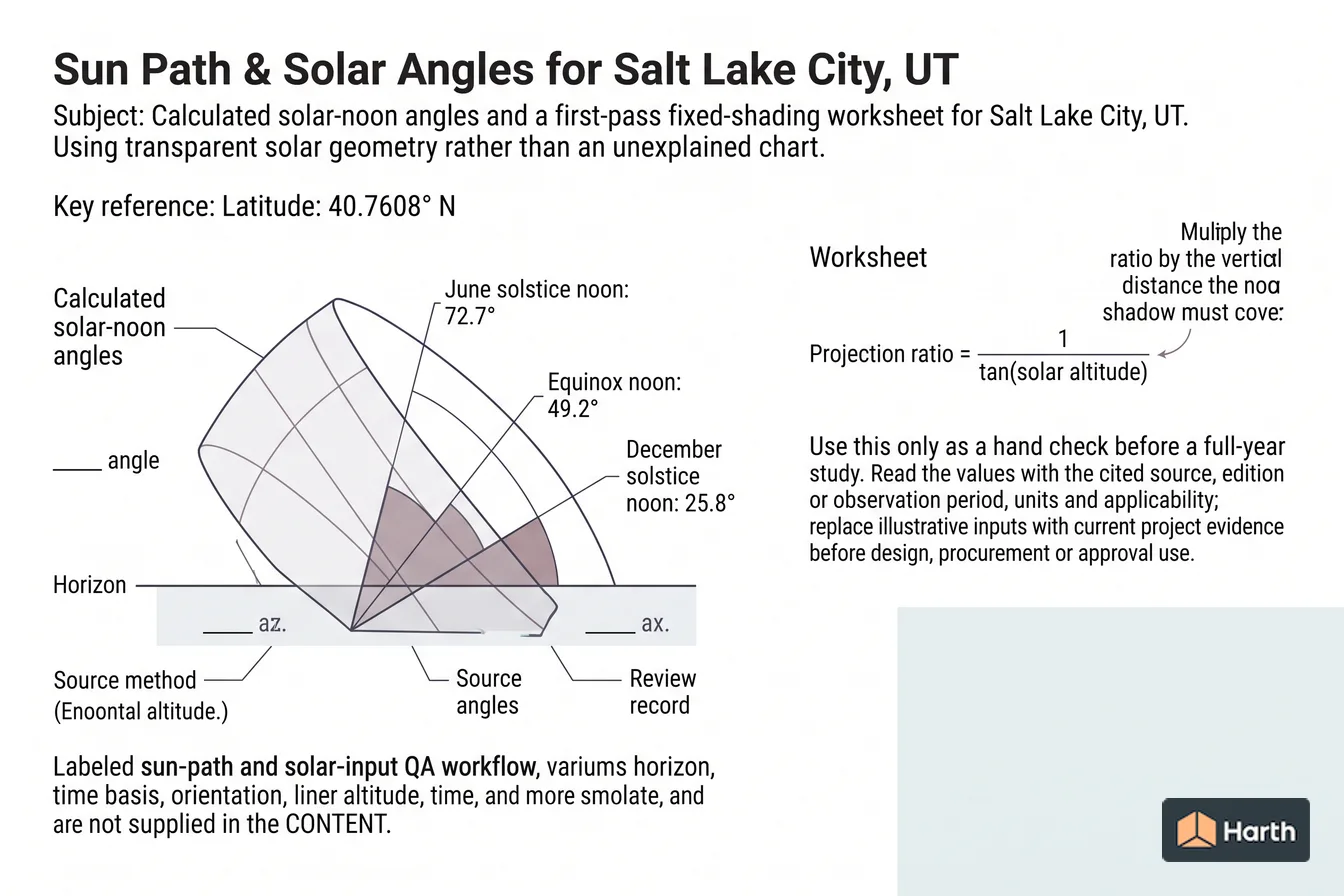
Calculated solar-noon angles and a first-pass fixed-shading worksheet for Salt Lake City, UT, using transparent solar geometry rather than an unexplained chart. A key reference is latitude: 40.7608° N; check the cited source, edition, units, and applicability before using it for design, compliance, procurement, or approval. Latitude is 40.7608° N; Salt Lake City, UT. June solstice noon is 72.7°; south at solar noon. Equinox noon is 49.2°; geometric solar noon. Projection ratio = 1 / tan(solar altitude). Multiply the ratio by the vertical distance the noon shadow must cover. Use this only as a hand check before a full-year study. Read the values with the cited source, edition or observation period, units and applicability; replace illustrative inputs with current project evidence before design, procurement or approval use.
Content and cited inputs reviewed by Harth team · Published 2026-08-17 · Updated 2026-08-17.
Which solar conditions control the result?
| Date | Declination | Altitude | Projection / vertical shade distance |
|---|---|---|---|
| June solstice | +23.44° | 72.68° | 0.312 |
| Equinox | 0° | 49.24° | 0.862 |
| December solstice | -23.44° | 25.80° | 2.069 |
Projection ratio = 1 / tan(solar altitude). Multiply the ratio by the vertical distance the noon shadow must cover. Use this only as a hand check before a full-year study.
Salt Lake City, UT shading record
Record facade azimuth, window head and sill, overhang height, required shaded dates and hours, coordinates (40.7608° N), time zone (America/Denver), calculation method, surrounding obstructions, reviewer and date. Compare the full model against the three noon ratios above and retain screenshots of the critical summer and shoulder-season hours. Verify hourly positions with the NOAA Solar Calculator.
Where can you explore related guidance?
- Explore all solar data guidance
- Understanding Sun-Path Diagrams
- Solar Altitude and Azimuth: Meaning, Formulas & Worked Example
- Climate Design Data Workflow for Salt Lake City, UT
Sources and method
Original calculation using latitude 40.7608° N and declinations +23.44°, 0°, and -23.44°. Formula: altitude = 90° - |latitude - declination|. Time zone: America/Denver. Verify occupied-hour positions with the NOAA Solar Calculator; values omit refraction, equation of time, terrain, obstructions, and facade azimuth.
Source links
Frequently asked questions
What is the sun angle in Salt Lake City, UT at the summer solstice?
The declination-only solar-noon altitude is approximately 72.7°. This is a transparent geometry check, not a substitute for an hourly solar-position calculation.
Related pages
- Sun Path & Solar Angles for New York, NY
Sun-path design data for New York, NY: solstice and equinox solar-noon altitude, shadow ratios, assumptions, and an architect-oriented shading worksheet.
- Sun Path & Solar Angles for Phoenix, AZ
Computed Phoenix solar-noon angles for the solstices and equinox, with a reproducible method and practical shading guidance for hot, sunny facades.
- Sun Path & Solar Angles for Portland, OR
Sun-path design data for Portland, OR: solstice and equinox solar-noon altitude, shadow ratios, assumptions, and an architect-oriented shading worksheet.
- Sun Path & Solar Angles for San Diego, CA
Sun-path design data for San Diego, CA: solstice and equinox solar-noon altitude, shadow ratios, assumptions, and an architect-oriented shading worksheet.
- Sun Path & Solar Angles for San Francisco, CA
Sun-path design data for San Francisco, CA: solstice and equinox solar-noon altitude, shadow ratios, assumptions, and an architect-oriented shading worksheet.
- Sun Path & Solar Angles for Seattle, WA
Sun-path design data for Seattle, WA: solstice and equinox solar-noon altitude, shadow ratios, assumptions, and an architect-oriented shading worksheet.