Zoning
Floor Area Ratio (FAR): Meaning, Formula & Worked Example
What floor area ratio means, how to calculate the maximum buildable floor area on a lot, and a worked example architects can reuse.
On this page
Last updated August 14, 2026 · Concept explainer based on standard U.S. zoning practice. FAR limits, exemptions, and the exact definition of countable floor area vary by municipality; the local zoning ordinance is authoritative. FAR values shown are illustrative, not code citations. Official references: [NYC Zoning Resolution](https://zr.planning.nyc.gov/). District FAR examples: [NYC Zoning Resolution 23-21](https://zr.planning.nyc.gov/article-ii/chapter-3/23-21) and [23-22](https://zr.planning.nyc.gov/article-ii/chapter-3/23-22) (last amended 2024-12-05); [Chicago Department of Buildings, Zoning 101](https://www.chicago.gov/content/dam/city/depts/bldgs/general/Self_Cert_Program/2019/14-ZONING.pdf) (2019-12-01); floor space ratio definition: [NSW Standard Instrument LEP cl 4.5](https://classic.austlii.edu.au/au/legis/nsw/consol_reg/silep531/s4.5.html).
Direct answer
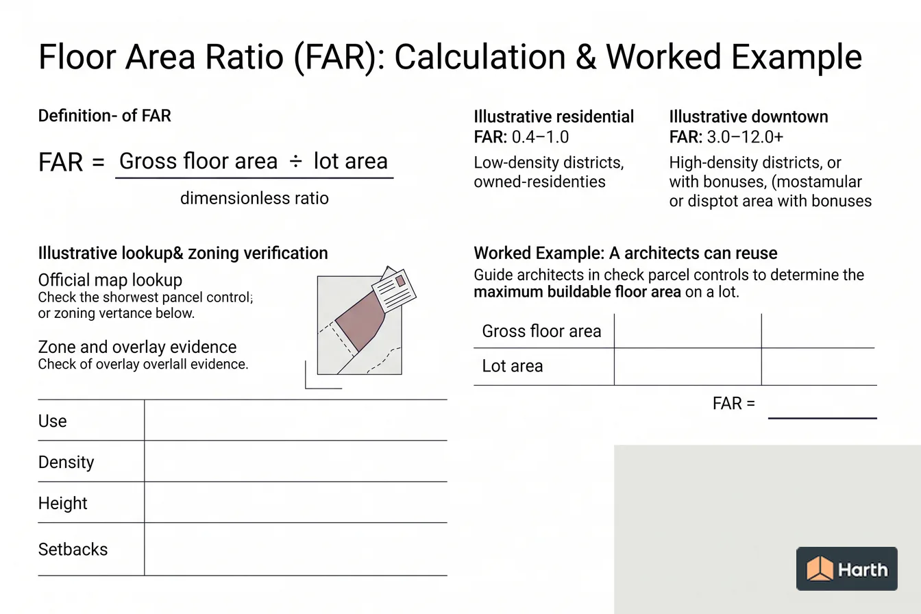
What floor area ratio means, how to calculate the maximum buildable floor area on a lot, and a worked example architects can reuse. A key reference is illustrative residential far: 0.4–1.0; check the cited source, edition, units, and applicability before using it for design, compliance, procurement, or approval. FAR definition is Gross floor area ÷ lot area; a ratio, dimensionless. Illustrative residential FAR is 0.4–1.0; low-density districts. Illustrative downtown FAR is 3.0–12.0+; high-density / with bonuses. Floor area ratio (FAR) is the ratio of a building's total countable floor area to the area of its lot. It is dimensionless: Read the values with the cited source, edition or observation period, units and applicability; replace illustrative inputs with current project evidence before design, procurement or approval use.
Content and cited inputs reviewed by Harth team · Published 2026-08-14 · Updated 2026-08-14.
What does this term mean?
Floor Area Ratio (FAR): What floor area ratio means, how to calculate the maximum buildable floor area on a lot, and a worked example architects can reuse.
What does FAR stand for in real estate and construction?
FAR stands for floor area ratio. It is the amount of floor space a zoning code allows on a lot, stated as a multiple of the lot's own area, and it is the single number planners, developers and architects use first to size what a site can hold. A lot zoned at a FAR of 2.0 can carry countable floor area equal to twice its land area. Some jurisdictions use a different name for the same ratio: floor space ratio (FSR) in New South Wales planning instruments, and floor space index (FSI) in parts of India.
| To find | Formula |
|---|---|
| FAR of a building | FAR = gross floor area ÷ lot area |
| Maximum floor area on a lot | Max floor area = FAR × lot area |
| Storeys at a uniform footprint | Storeys = FAR ÷ lot coverage (as a decimal) |
| Lot area needed for a target floor area | Lot area = floor area ÷ FAR |
"Gross floor area" here means floor area as the local ordinance defines it — the counted total, after any exclusions the code allows.
Which parcel controls must be checked?
Floor area ratio (FAR) is the ratio of a building's total countable floor area to the area of its lot. It is dimensionless:
$$ \text{FAR} = \frac{\text{gross floor area}}{\text{lot area}} $$
A FAR of 1.0 means you can build floor area equal to the lot area — a single story covering the whole lot, or two stories covering half of it. FAR caps total floor area; height, setbacks, and lot coverage shape how that area is distributed.
Worked example
Assume a 10,000 sf lot in a district with a 2.0 FAR limit.
| Step | Value |
|---|---|
| Lot area | 10,000 sf |
| FAR limit | 2.0 |
| Max countable floor area | 20,000 sf |
| At 50% lot coverage | ~4 floors of 5,000 sf |
| At 40% lot coverage | ~5 floors of 4,000 sf |
The same 20,000 sf can take many forms — a squat, wide building or a taller, slimmer one — as long as height and setback limits are met.
What a given FAR looks like on a 10,000 sf lot
FAR fixes total floor area, not shape. Dividing FAR by the share of the lot the building covers gives the number of storeys, assuming every floor has the same footprint and all of it counts:
| FAR | Max floor area | Storeys covering the whole lot | Storeys covering half | Storeys covering a quarter |
|---|---|---|---|---|
| 0.5 | 5,000 sf | — | 1 | 2 |
| 1.0 | 10,000 sf | 1 | 2 | 4 |
| 2.0 | 20,000 sf | 2 | 4 | 8 |
| 3.0 | 30,000 sf | 3 | 6 | 12 |
| 6.0 | 60,000 sf | 6 | 12 | 24 |
Most districts also cap lot coverage, height and setbacks, so several cells in this table will be unbuildable on a real parcel; the table shows the arithmetic, not an entitlement.
Illustrative FAR ranges
| District type | Illustrative FAR |
|---|---|
| Low-density residential | 0.4–1.0 |
| Medium-density / mixed-use | 1.0–3.0 |
| Commercial corridor | 2.0–5.0 |
| Downtown / high-rise core | 3.0–12.0+ (often with bonuses) |
These ranges are directional. The controlling FAR for a parcel — and what floor area actually counts toward it — comes from the local ordinance.
Is there a standard FAR?
No. There is no national or default FAR: each zoning district in each ordinance sets its own limit, and the figure moves when the ordinance is amended. Two official examples show how differently codes express it.
New York City sets residential FAR by district in Zoning Resolution sections 23-21 (R1–R5) and 23-22 (R6–R12), both last amended 5 December 2024 under City of Yes for Housing Opportunity:
| NYC district | Maximum residential FAR | Higher FAR available | What unlocks it |
|---|---|---|---|
| R1, R2, R3 (most variants) | 0.75 | 1.00 | Qualifying residential site (ZR 23-21) |
| R4 | 1.00 | 1.50 | Qualifying residential site (ZR 23-21) |
| R5 | 1.50 | 2.00 | Qualifying residential site (ZR 23-21) |
| R6B | 2.00 | 2.40 | Qualifying affordable or senior housing (ZR 23-22) |
| R6 (beyond 100 ft of a wide street) | 2.20 | 3.90 | Qualifying affordable or senior housing (ZR 23-22) |
| R8A, R8X | 6.02 | 7.20 | Qualifying affordable or senior housing (ZR 23-22) |
| R10 | 10.00 | 12.00 | Qualifying affordable or senior housing (ZR 23-22) |
| R12 | 15.00 | 18.00 | Qualifying affordable or senior housing (ZR 23-22) |
ZR 23-21 also limits floor area tied to any single dwelling unit on standard R1–R5 lots of 4,000 sf or more to an equivalent FAR of 0.60, and some R6–R8 values differ within 100 feet of a wide street. These figures replaced earlier ones in December 2024, so older references may quote different numbers.
Chicago builds FAR into many district names. The city's Department of Buildings Zoning 101 guide (December 2019) gives DX-5 (maximum FAR 5.0) and B3-3 (maximum FAR 3.0) as examples, but notes RM-4.5 allows 1.70 — so the suffix is not a FAR in every district. Chicago also applies FAR to net site area (site area minus any public way), not the gross parcel.
For a real parcel, read the current ordinance text and official zoning map, then check overlays, special districts and bonus programs that change the base figure.
Where FAR meets the rest of the code
FAR rarely acts alone. A parcel might have generous FAR but be limited by height or setbacks before it can reach the FAR ceiling. Read FAR alongside the other bulk standards described in understanding zoning districts.
Test it on your site
Drop your lot dimensions into a Harth massing study, set the FAR and height limits for your district, and watch the buildable envelope resolve in real time — so you can see whether FAR or height is the binding constraint before schematic design.
Floor Area Ratio (FAR): Meaning, Formula & Worked Example: parcel-control verification record
| Planning field | Project entry | Official evidence |
|---|---|---|
| Address, parcel and lot geometry | — | Survey / assessor record |
| Base zoning district | — | Official map lookup and capture date |
| Overlays / special districts | — | Official map and ordinance references |
| Use and approval pathway | — | Current use table / authority advice |
| FAR, coverage and floor-area definition | — | Ordinance section and calculation |
| Height, setbacks and yards | — | Ordinance sections and lot-line basis |
| Exceptions, variances and prior approvals | — | Recorded decisions / property file |
| Planner / qualified reviewer and date | — | Project QA record |
Project-use verification: leave controls blank until the parcel, map, ordinance and overlays agree. The authority having jurisdiction and recorded approvals control.
Where can you explore related guidance?
- Explore all zoning guidance
- Zoning Districts Explained: Residential to Mixed-Use
- Residential Setback Requirements: Front, Side & Rear Explained
- Zoning in Austin, TX: District Families & Illustrative Standards
Sources and method
Concept explainer based on standard U.S. zoning practice. FAR limits, exemptions, and the exact definition of countable floor area vary by municipality; the local zoning ordinance is authoritative. FAR values shown are illustrative, not code citations. Official references: NYC Zoning Resolution. District FAR examples: NYC Zoning Resolution 23-21 and 23-22 (last amended 2024-12-05); Chicago Department of Buildings, Zoning 101 (2019-12-01); floor space ratio definition: NSW Standard Instrument LEP cl 4.5.
Source links
Frequently asked questions
How do I calculate maximum floor area from FAR?
Multiply the lot area by the district's FAR limit. Maximum gross floor area = lot area x FAR. For example, a 10,000 sf lot in a district with a 2.0 FAR yields up to 20,000 sf of countable floor area. The lot can hold that area on one floor at full coverage or spread it over several floors at lower coverage — FAR limits total area, not the number of stories, which height and setback rules constrain separately.
What counts as floor area for FAR?
FAR is based on gross floor area, but each ordinance defines exactly what counts. Many exclude below-grade parking, mechanical spaces, and unenclosed balconies, and some exclude portions of parking structures or ground-floor retail to encourage certain uses. Because these exclusions vary and materially change the buildable area, confirm the local definition of gross (or zoning) floor area before relying on a FAR calculation.
Can FAR be increased above the base limit?
Often, yes. Many cities offer density or FAR bonuses in exchange for public benefits — affordable housing, public open space, transit improvements, or historic preservation. Transferable development rights (TDR) can also move unused FAR from one parcel to another. These bonuses are defined locally and usually require an application and findings, so treat the base FAR as the starting point, not a hard ceiling.
What does FAR stand for in real estate?
FAR stands for floor area ratio: the total floor area a zoning district allows on a lot, divided by the lot area. Brokers, appraisers and developers use it to gauge how much building a parcel can legally carry, because floor area drives value. A FAR of 1.5 on a 20,000 sf lot means up to 30,000 sf of countable floor area, subject to the height, setback and coverage rules of the same district.
What is the standard FAR for a building?
There isn't one. FAR is set district by district in each local zoning ordinance, so the same building type can face very different limits in two cities or two blocks. In New York City, for example, residential FAR runs from 0.75 in R1–R3 districts to 15.00 in R12 districts under Zoning Resolution sections 23-21 and 23-22. Always take the figure from the current ordinance for the parcel's mapped district.
How do you calculate the FAR of an existing building?
Add up the floor area of every storey that the local ordinance counts, then divide by the lot area. A three-storey building with 4,000 sf floor plates on a 10,000 sf lot has 12,000 sf of floor area, so its FAR is 12,000 ÷ 10,000 = 1.2. Apply the ordinance's own definition of floor area first — excluded cellars, parking or mechanical space can change the result.
Related pages
- How to Read a Zoning Map & Find Zoning by Address (25 US Cities)
Decode zoning map codes such as R-4 or C-2/HD-O, check zoning by address parcel-first, and use official lookup portals for 25 US cities, verified 2026-08-17.
- Residential Setback Requirements: Front, Side & Rear Explained
What a setback is, how to find your property's setbacks, why the US has no national setback law (IRC R302.1), plus driveways, corner lots and encroachments.
- Zoning Districts Explained: Residential to Mixed-Use
Understand residential, commercial, industrial, and mixed-use zoning districts, then verify permitted uses and dimensional standards for a parcel.
- Zoning in Austin, TX: District Families & Illustrative Standards
Understand Austin zoning district families and the parcel controls architects must verify in the current Land Development Code and official map.